|
KOMARNO
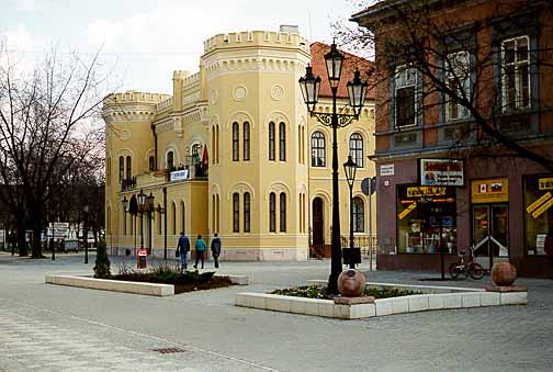
Komarno, laying on the
South -East part of Zitny Ostrov (Rye Island) at the confluence of the
Danube and the Vah rivers is one of the oldest settlements in the
Carpathian Basin and has rich history. According to the evidence of
archaeological finds it is probable that the town's territory has been
permanently inhabited since the later Bronze Age.
From the end of the 4th
century BC Transdanubia was being occupied by the Celts who founded
several settlements also near the mouth of the river Vah. In the 1st
century AD the Roman Empire extended her frontiers as far as the Danube.
Roman camp and the town Brigetio were founded in the place of the former
Celtic settlements. From the end of the 4th century AD the Romans were
gradually pushed out of Panonia by the strengthening attacks of the
barbarian tribes. According to archaeological finds in the Early Middle
Ages Avars were staying in the area of Komarno for a longer period.
During the 10th century
the tribe of duke Ketel settled around the mouth of the river Vah. He
built his winter residence at the confluence of the Danube and the Vah.
His son Alaptolma fortified it.
In the time of forming of
the Hungarian Empire this place surrounded by fortified walls became the
center of the Komarno County. A castle measuring 850 meters in length was
built behind the walls of the fort and near by at the crossing of
important land and water-ways a settlement arose. In the earliest document
the settlement is mentioned as Camarun (1075), Kamarn (1218), Camarun
(1268), Kamar (1283), Camaron and Comaron (in several documents between
years 1372-1498).
"Villa Camarun"
was one of the 23 settlements, which belonged to the domain of Komarno
castle. King Bela IV granted the first significant privileges (belonging
only to towns in those days) in his charter of April 1st, 1265.
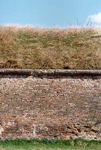
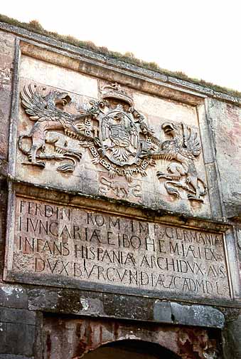
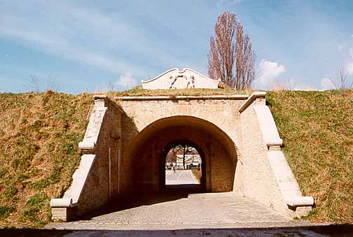
In the 16th century,
during the Turkish expansion, Komarno is squeezed between the Habsburghs and Ottoman Empire. That is why in the middle of the 16th century, under
the reign of Ferdinant I, the medieval castle is rebuilt into a
well-fortified fort. This old fortification is enlarged and rebuilt again
in the course of anti-Turkish wars with New Fort. Both of these forts
successfully resisted the attacks of the Turkish army.
In the 18th century after
expelling the Turks from the kingdom and the end of the anti-Habsburghs
uprisings, due to its advantageous location at the crossing of land and
water-ways Komarno becomes one of the largest towns of the kingdom with
flourishing trade.
In spite of the
earthquakes and many other destructive calamities as floods, fires, plaque
and cholera epidemics, Komarno continues to be an important trading
center up to the middle of the 19th century.
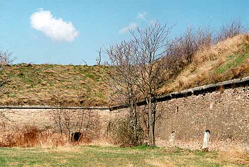
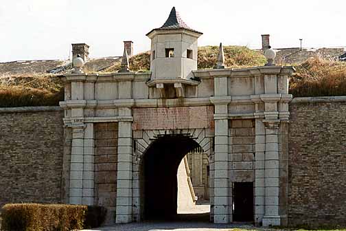
During the Napoleon's wars
the construction of the extensive Komarno fortified system began. Its
building was interrupted by the revolutionary events in 1848-49 in which
Komarno played an important role as the last bastion of the Hungarian
bourgeois revolution. After the fighting the town, destroyed by a great
fire and a siege, was in ruins. In the years of Austrian absolution
military buildings were especially built here.
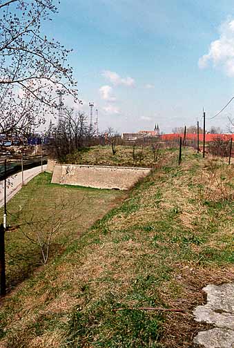
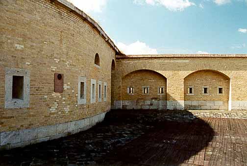
In 1870's, after
finishing the construction of the fortified system, Komarno became a
strategic military base of Austro-Hungary.
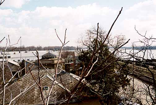
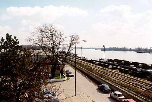
It started to develop
again only at the end of the 19th and the beginning of the 20th
century. New iron bridges were built over Danube and Vah rivers, first
railway lines linked Komarno with other and further parts of the country,
new industrial plants were built also. A town on the right side of Danube,
Ujszony was amalgamated with Komarno, the town became larger and gained
much needed space for its development. After the breakup of the Austro-
Hungarian Empire and the forming of the Czecho-Slovak Republic, state
border separated historical Komarno county and the town itself. Part of
Komarno lying on the left side of the Danube became the county of the
nearby-formed Raba-Komarno-Esztergom County. By territorial
reorganization in 1923 this county was abolished and Komarno became the
seat of Komarno district.
© Claudia Veghova
All
photographs are for sale
GO
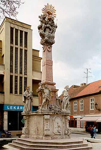
TO PRIDE OF KOMARNO
GO
TO STONE VIRGIN OF KOMARNO
GO
BACK TO TOWNS AND VILLAGES
Published in the
Slovak Heritage Live newsletter Volume 5, No. 2, Summer 1997
Copyright © Vladimir Linder 1997
3804 Yale
Street, Burnaby, British Columbia, Canada V5C 1P6
The above article and
photographs may not be copied, reproduced, republished, or redistributed
by any means including electronic, without the express written permission
of Vladimir
Linder. All rights reserved.
|